Greetings to blog readers from Manitoba! This is my very first blog post inspired by a place in Manitoba. A 2021 trip to your province has provided me with enough material for several posts and that’s good because Manitoba is a very long drive from Edmonton. I hope you enjoy them. I’ve tried to make this blog more about the images and less of a history lesson like the last blog post was, although the story of the two barns and two men in Saskatchewan contained some facinating history to read, even if I do say so myself.
In The Middle of Nowhere
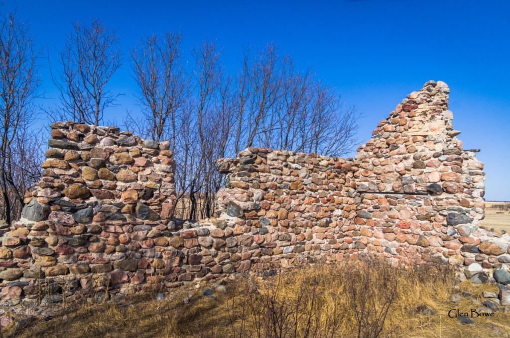
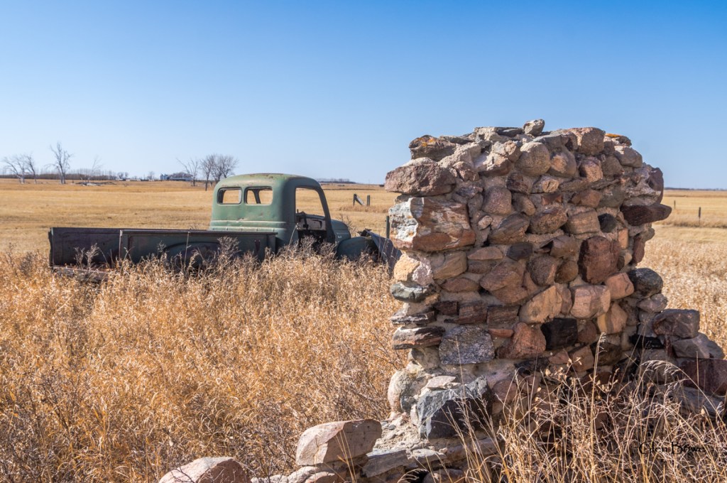
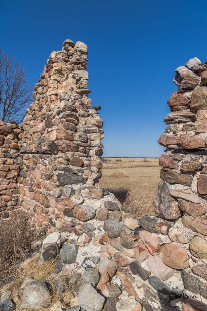
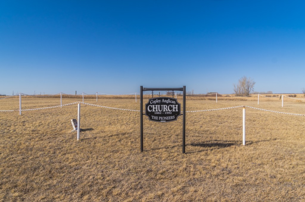
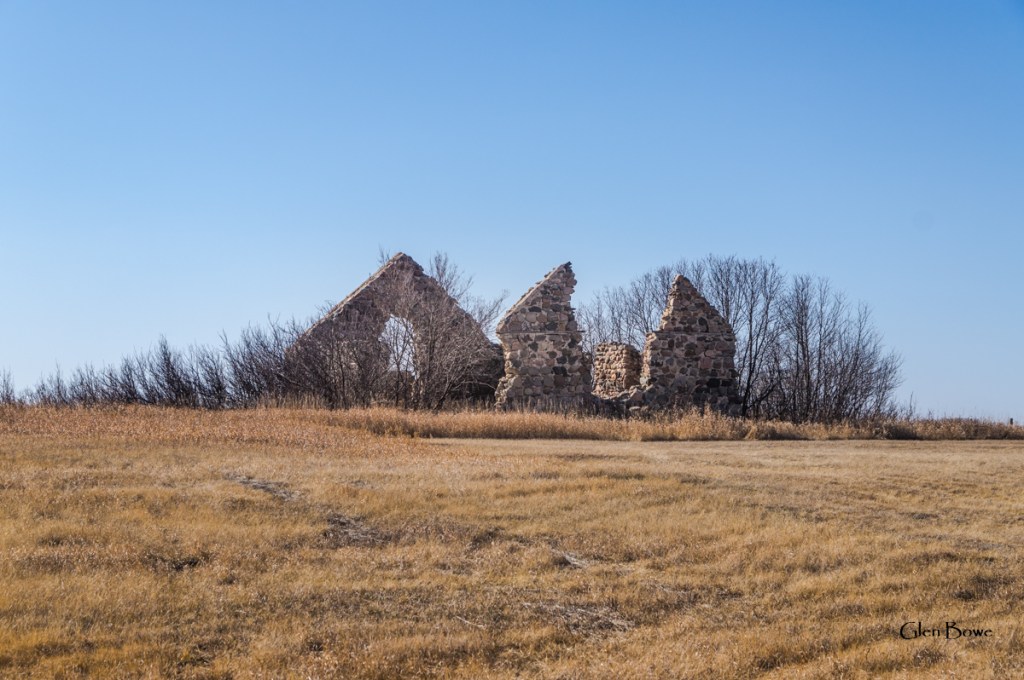
In the deep southwest of Manitoba there is a sight that looks more British than Canadian, and that’s why I’m calling it Manitoba’s Stonehenge. This place shares a lot in common with the actual Stonehenge. Stones are piled upon stones, shapes are pointing to the sky and time has eroded everything else away. This site in Manitoba is similar to Stonehenge (to the extent that we can ever know anything about Stonehenge) in that we know that this structure was built for religious observance. Unlike Stonehenge, which is very close to a major motorway in the UK, Manitoba’s Stonehenge is difficult to reach. Picture a map of Manitoba and then visualize a place in the extreme southwest. In fact it’s so far south and west that, if you are looking at a map of the whole province, it will appear to be right on the American or Saskatchewan borders. It’s only a few kilometers from either border as the crow flies. That remote location is where I went to capture a number of images of what was once St. George’s Anglican Church but is now known as Copley Anglican Church.
A Brief History of Copley Anglican Church Ruins
I’m just going to quote directly from The Manitoba Historical Society’s website that describes what this place once was.
Known formally as St. George’s Anglican Church, local names for this abandoned fieldstone structure in the Municipality of Two Borders were Butterfield Church and Copley Church. Through the fundraising efforts of Goddard F. Gale, construction by local settler William Cornwallis Bate began in the autumn of 1890 and the church was ready for use by the spring of 1892. On 4 September 1892, it was consecrated by Bishop Robert Machray, assisted by Canon S. P. Matheson, Reverend Charles Wood, and Reverend Frank Mercer. The first burial in the associated cemetery occurred a month later.
Manitoba Historical Society Historic Sites of Manitoba: Copley Anglican Church and Cemetery (Municipality of Two Borders) (mhs.mb.ca)
As settlement in the surrounding area waned, church attendance diminished until the building was deconsecrated in June 1913. Church equipment was taken to a new building at Pierson while the organ and pictures were taken to Eunola School. Local lore indicates that, during the years of Prohibition, the isolated location of the building and its close proximity to the American and Saskatchewan borders made it attractive to bootleggers. Efforts were made in 1932 to protect the building from vandalism, by boarding the doors and windows. Since then, the elements have taken a toll. Still intact in 1967, only remnants of the original walls were present at the time of a 2011 site visit.
The only thing that I’ll add to the above history is that the reason that the settlement “waned”, according to an information card at the church location, was because of poor farming conditions in the late 1890s and early 1900s. See more on what went wrong and what happened to the people below.
How it Once Looked
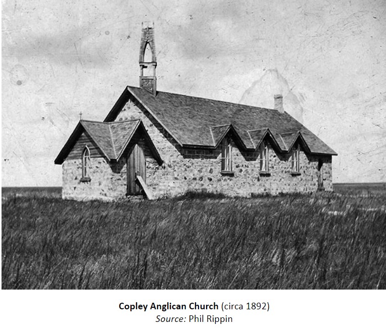
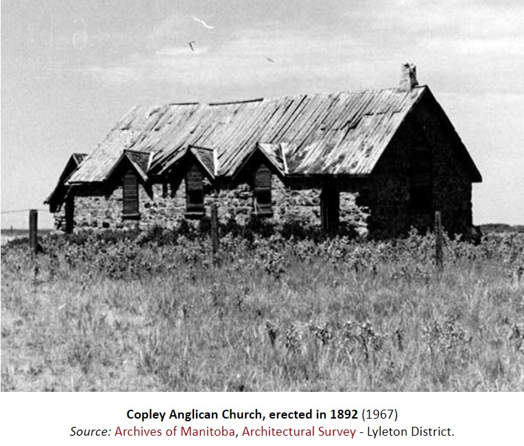
One image below dates back to approximately 1892 and the other one shows the church’s roof deteriorating in 1967. Both images are from the Manitoba Historical Socieity at Historic Sites of Manitoba: Copley Anglican Church and Cemetery (Municipality of Two Borders) (mhs.mb.ca). In the ruins I can still discern the remains of the entrance way as shown on the first image below as well as the straight wall (gable) on the opposite side of the church as can be seen in the second image below.
Images of the Church in 2021

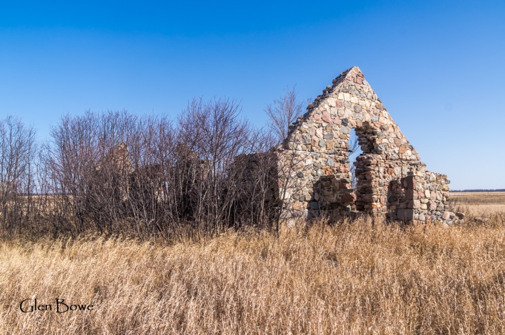
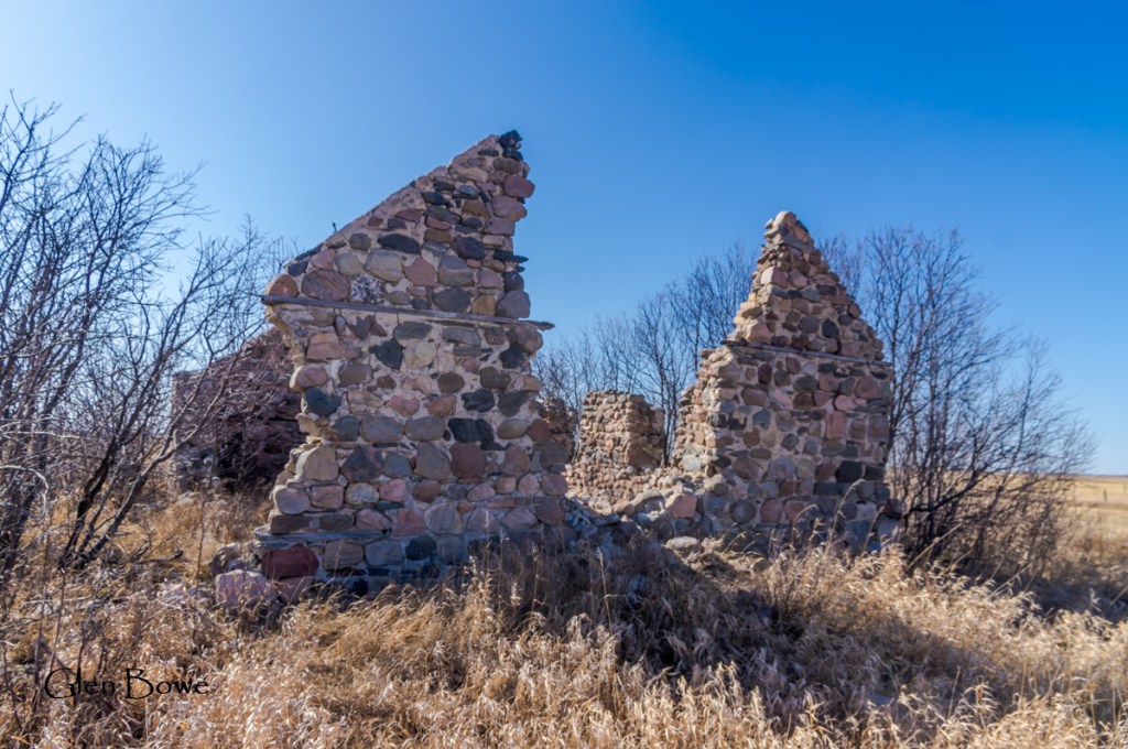


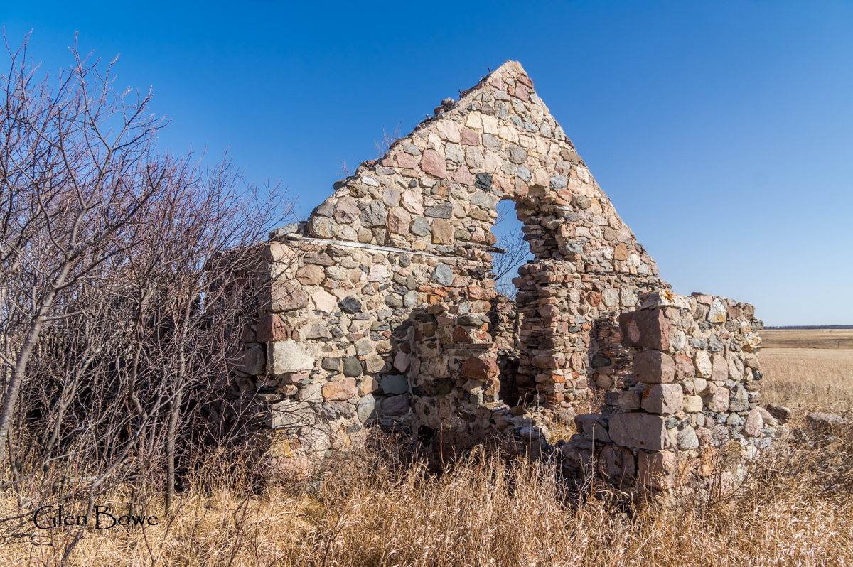


Below right you can see a burnt board sticking out a little into the open area that was once an entrance. The wood embedding in the stone was there to enable nailing of anything from door fixtures to interior walls. You can see the narrow wood inserts on both images.

What Happend to the People?
This church was built to last a long time. The people came, primarily from the UK, filed with optimism. What they didn’t know was that this part of Manitoba suffers from the same fate that doomed the early settlers to southern Alberta and some parts of southern Saskatchewan. It’s too dry without irrigation to farm. It’s almost that simple but there is more. After this blog post was completed and published I came across an excellent book by Gordon Goldsborough called, Abandoned Manitoba. I can’t say it better than he did in his book so I’ll quote from his book on the subject of what went wrong.
But the true nature of the Copley area soon became clear. Its general aridity made the soil prone to wind and water erosion. Below-average rainfall combined with crop losses due to gophers, fungus, and freak hailstorms doomed the community nearly from the start. Most settlers began to leave for greener pastures elsewhere. Gale and his wife moved to Winnipeg, where in 1894 he operated the Winnipeg School of Art and Design on Main Street before moving to San Francisco, California. There, he took several famous panoramic photographs of the devastated city following a 1906 earthquake. Other Copely Settlers moved to nearby Lyleton, where growing conditions were better, but others returned to England or went to Saskatchewan, or the United States, or Australia. By 1903, St George’s had almost no parishioners. In June 1913, the impressive stone building was deconsecrated, after being used for just 20 years.
Abandoned Manitoba; Gordon Goldsborough, page 60
The Copely Church, and the parishioners’ homes, could possibly be among the first of the permanent structures to be abandoned on the prairies (excluding the forts of the Hudson Bay Company).
The Cemetery
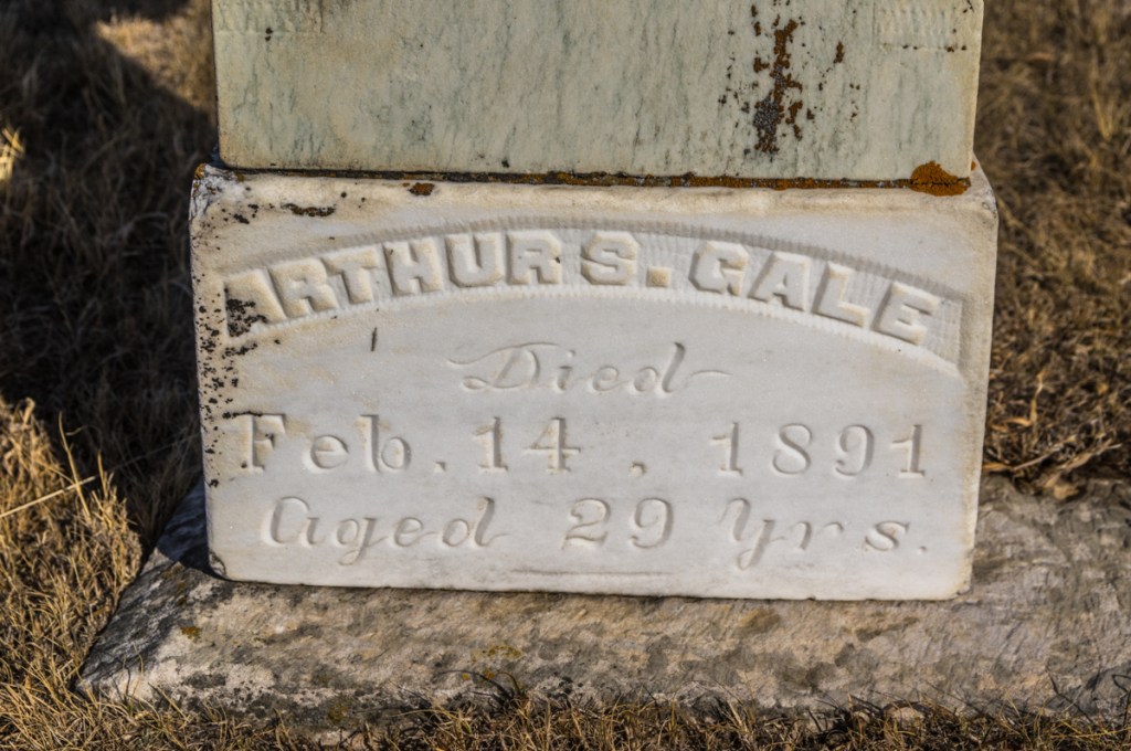
Many, perhaps most, old churches have a cemetery next to the building or at least nearby. This church is no exception. Unfortunately there are only a few markers. I came across an information card that said there are approximately 11 graves in the cemetery, though only three headstones exist on the site.

Most of these images were captured between 3:00 and 3:30 in April of 2021 which is not the best time for photography. If I had more time, or had planned fewer stops that day, I would have enjoyed photographing these ruins during the golden hour (one hour before sunset) and at sunset. Even an image with just the full moon in the sky lighting up ruins would be pretty nice. Perhaps, if this really were Manitoba’s Stonehenge, I might even catch a glimpse of some Manitoban Druids dancing around the ruins. Now that would make for an interesting photograph indeed!
Citations
Goldsborough, G. (2016). Abandoned Manitoba. Winnipeg: Great Plains Publications. Used for the above quote under “What Happened to the People”
Manitoba Historical Society. Historic Sites of Manitoba: Copley Anglican Church and Cemetery (Municipality of Two Borders) (mhs.mb.ca)

Love the history and your take on the places that are no longer inhabited. I may be doing a motorcycle trip out to Sask this summer Cypress Hills area, and if it works out, may have to pass by the Stonehenge of MB. Thanks Mr. Bowe!
LikeLiked by 1 person
Oh how I would love to buy a motorcycle again. My last one was an 88 BMW R100RT. It would be a great way to travel.
LikeLike
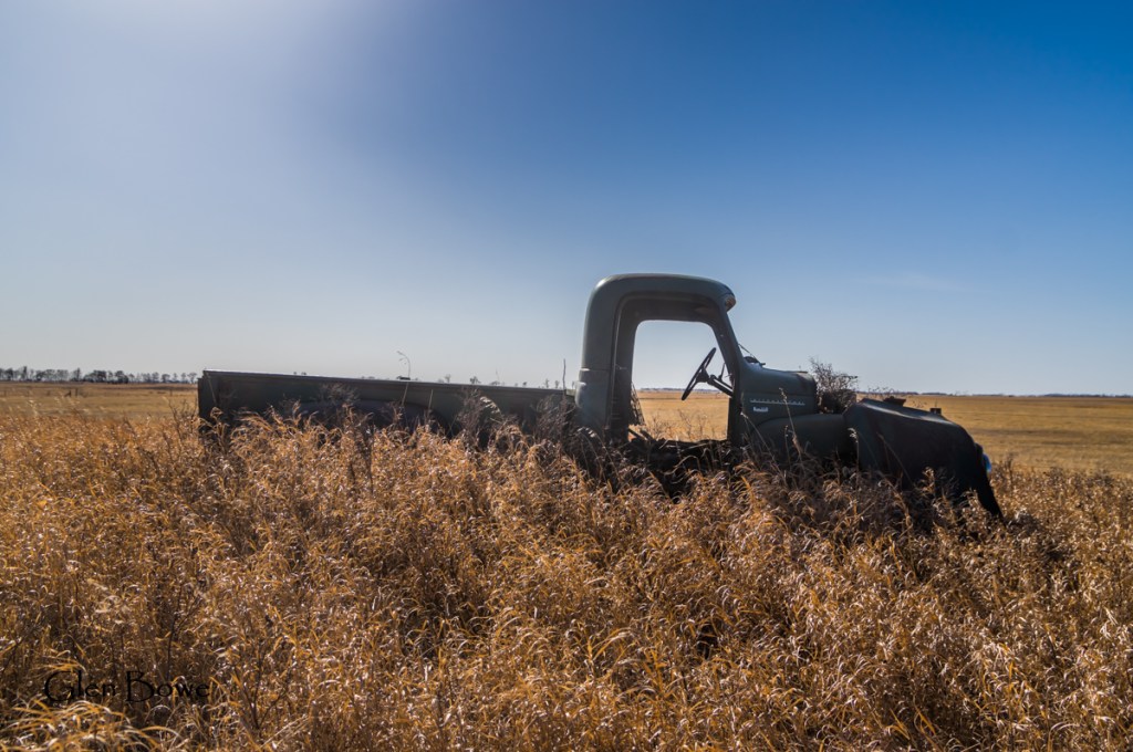
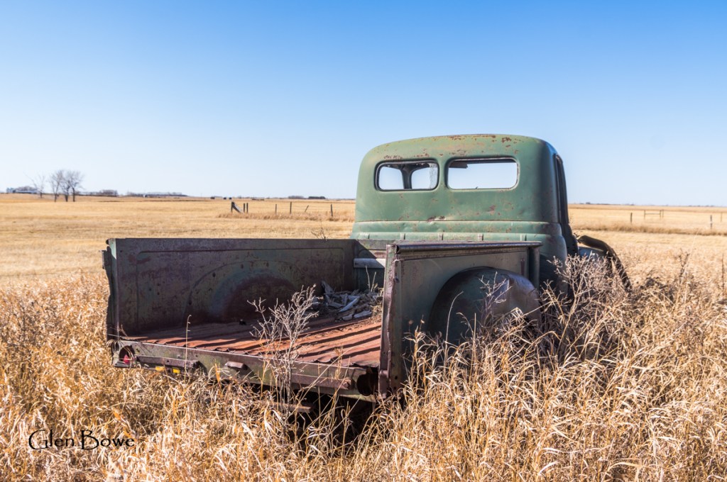
So sad to see it falling into ruin but on the other hand there’s a certain majesty to it even as it stands now. And the truck did, indeed, make me smile.
LikeLiked by 1 person
I’m glad you enjoyed all of the photos Mary Anne. The truck was probably used after the Serjeants sold the farm.
LikeLike
Don’t know why, but sometimes my comments show as being from ‘marmic1954’ when I normally use my first name. Oh well, I guess you know it’s me!
LikeLiked by 1 person
It must be in your settings somewhere. I see “Mary Anne” above Magpiesmumblings.
LikeLike
Despite my previous comment you’re right, I see Mary Anne and sometimes just Marmic 1954. That is strange.
LikeLike
Nothing like an old truck or car to enhance a rural prairies photo Glen. Thanks for sharing. Allan
LikeLiked by 1 person
Thank you Allan. This was one of my favourites photo locations from 2021.
LikeLiked by 1 person